A skyline is one of the most iconic things a city can offer.
Great skylines are rare – New York and Paris have terrific, unique skylines. But most cities are just a cluster of square towers.
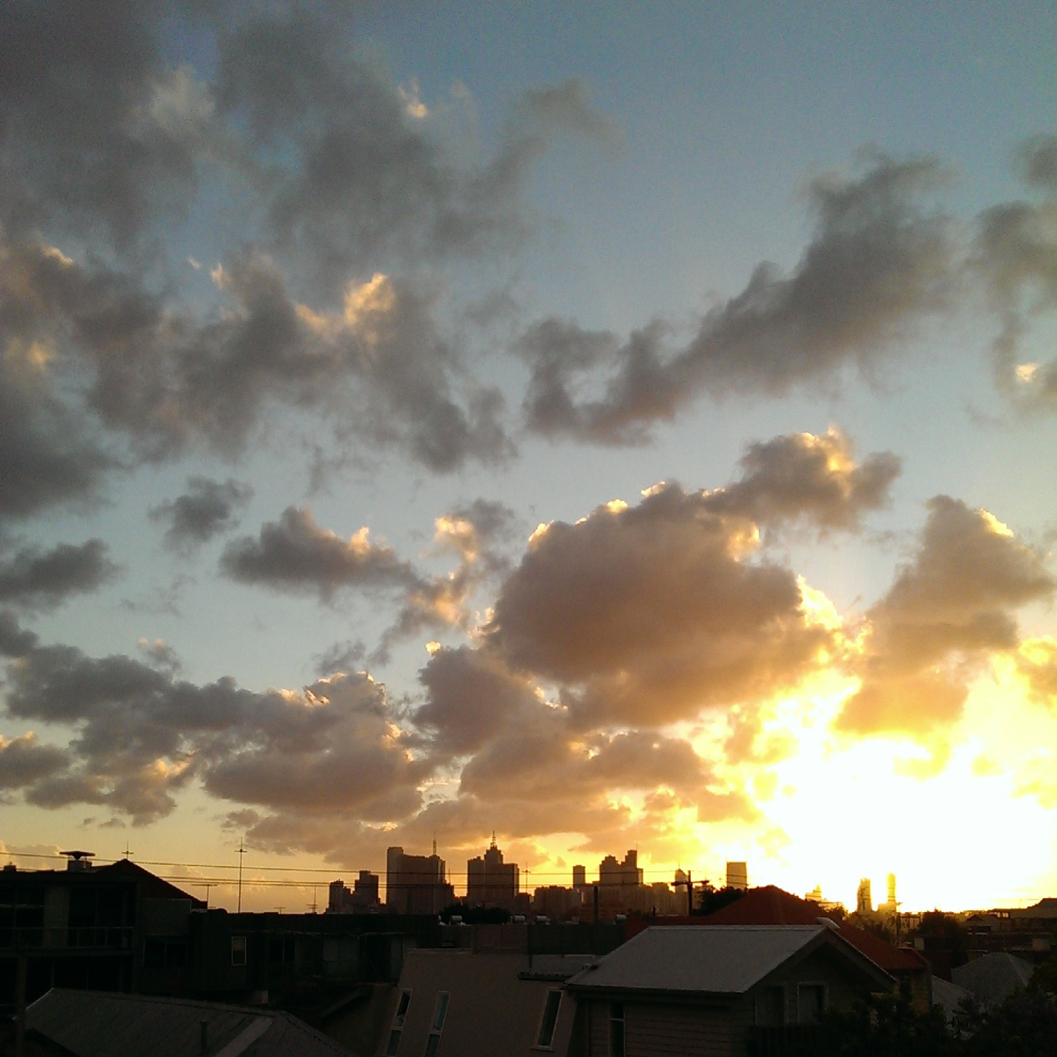
Melbourne’s skyline, from many angles, is a classic example. Nice in the right light, but far from distinctive.
Melbourne’s more iconic features (Arts Centre Spire, Wheel, Bolte Bridge) are hard to get in frame with the CBD.
The Eureka Tower – Melbourne’s tallest building – isn’t a great building to my eye, but it is so prominent that it is now a feature in tourist mementoes.
Skylines are a classic economic problem. The benefit of the skyline accrues not the to building’s owner, but to the people who gaze upon it. These are externalities, and so the market for a city skyline is clearly subject to market failure.
Worth mentioning – these external benefits are more than just warm fuzzy feelings. There is a reason houses on top of hills sell for a lot more. “City views” is a magic word in real estate.
When a building owner decides to make another 25-storey square grey tower, they’re not thinking about the city at large. What is most profitable for them is not necessarily what’s best for the skyline.
The Eiffel Tower was not a result of market forces. Neither was the Statue of Liberty. The Empire State Building was privately built, but that was in the 1920s, when market failures were left free to thrive and vast fortunes were sloshing around New York. Then, a handful of wealthy new Yorkers could afford to put up a signature building that would lose money for its first 20 years.
Will the sharpness of modern market forces deliver us only the drabbest lumps to adorn our horizons? If so, that’s truly a shame.
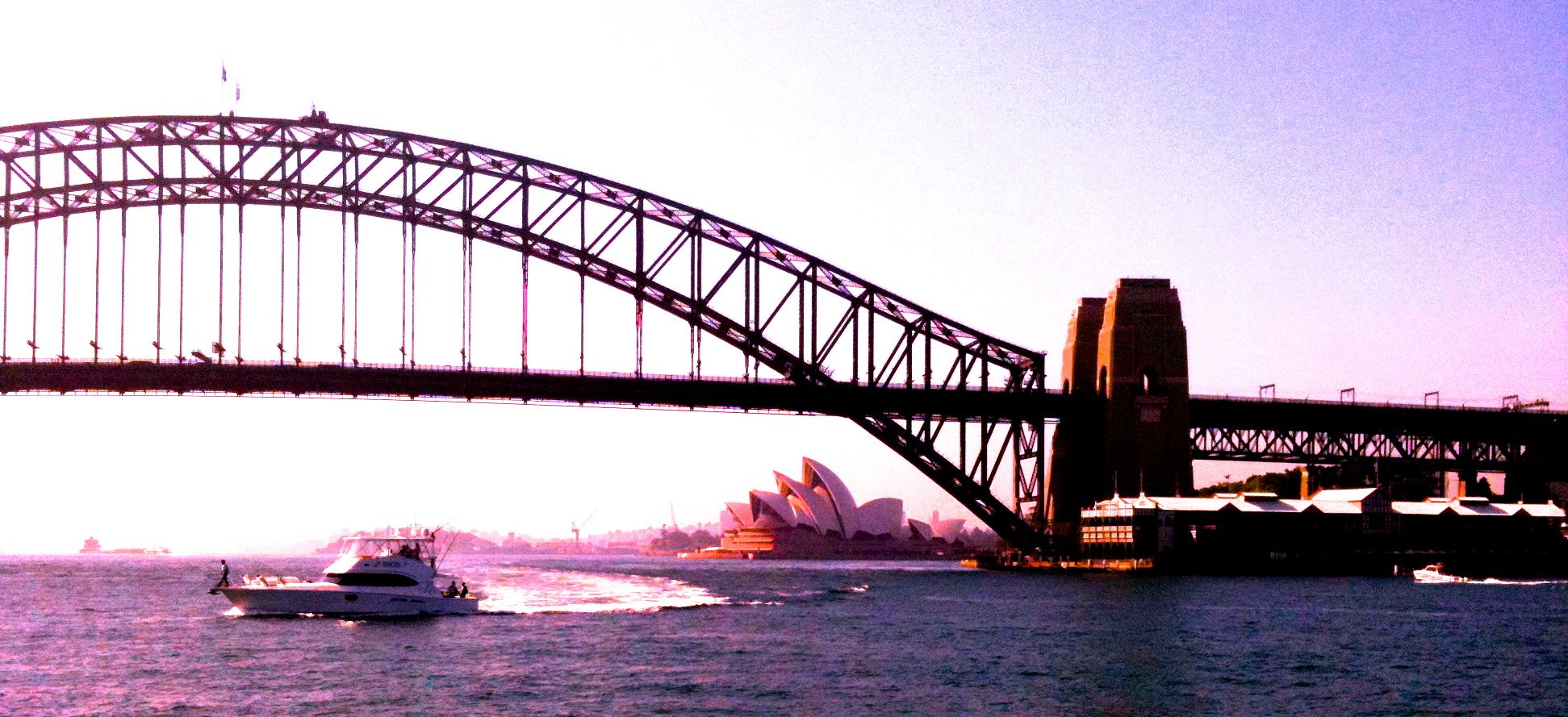
There are lessons in Australia’s history we can learn from. One of them is the screw-up that is Sydney.
Sydney was well-placed to become the London of Australia. A prime location, settled first, the early seat of power. It had it all. But while London remains by far the wealthiest and biggest city in the UK, Sydney is on-track to be overtaken by Melbourne in population.
If Melbourne overtakes Sydney, it won’t be the first time. Sydney had a 40-year headstart and yet lost its lead in the 19th century. At that stage the reason was the Gold Rush. Sydney got its lead back when a financial crisis hit in the 1890s.
Sources: various, but consider this a rough approximation.
If Sydney is overtaken by Melbourne in population, you can’t blame the Sydney-siders. They work hard, but they’re behind the eight-ball. The problem is the harbour.
If you think of it as public space, it’s lovely to look at and nice to use. But if you think of it as distance, is it smart to put so much of it right in the middle of your city? Do you really want so much distance between inner-city suburbs? Wouldn’t it be better to have a network of streets?
I contend that the harbour creates a massive problem in the middle of Sydney. The CBD is unable to connect properly into adjacent suburbs because they are a ferry-ride away.
Sydney has more than one major business cluster. The city competes with North Sydney and Parramatta.
But I’d argue that’s a sign of weakness, not of strength. Of course every city has suburban centres, but powerhouses like New York and London aren’t confused about where might be the centre of power, or the best spot to locate a business. Sydney’s situation whispers: this city is too big to really be one functional city. But globally-speaking, Sydney is not even that big, population wise.
So, the harbour in the middle could be part of the problem. But the harbour became the centre of Sydney only when a bridge was built that made the north shore more accessible. You can see the population develop in this video and the north only really takes off after 1932, when the final rivet was painted.
The smart move would have been to densely fill in the area to the south, intensively, before building to the north.
We’ve all played computer games where you have to build certain things in a certain order. If you build too many of the wrong thing too early, you get out of whack, run out of gold and you can’t beat the game. I’d argue that’s what Sydney did.
The Bridge was built using £6.25 million of public money. That represented about 2 per cent of NSW’s GDP at the time. For comparison, 2 per cent of GDP now would be about $10 billion. (sources: 1, 2)
Despite using tolls to pay it off, the debt lingered until 1988.
The opportunity cost? Not just the proper development of contiguous land areas, but also what that money might have bought if spent differently. When the rest of the world was building world class public transport systems, Sydney let theirs go.
If Sydney didn’t build the bridge, the city might have simply left the harbour as a boundary on the north. Of course some people would have chosen to live there still, but probably fewer. There’s plenty of space to the south that could have become very desirable had the economic centre of the city not been shifted north by the “coat-hanger”.
London has lots of bridges but the wealth and the productivity is overwhelmingly on one side of the Thames. It required Manhattan house prices to reach many millions before Brooklyn got any buzz, and Shanghai only developed the far side of the Huangpu in the last 20 years.
I’d be very interested to see a meta-analysis of whether, in the last 50 years, the value of having a river has turned from positive to negative in terms of a city’s economic growth. The impediments a big river would create to city connectivity are likely to be significant, especially where bridges are in short supply.
All this is very interesting, but we can’t go back and unbuild the Sydney Harbour Bridge. So what’s the point?
The point is we can learn a valuable lesson. Don’t spend valuable taxpayer resources providing infrastructure that will “shape” your city in the wrong way.
Infrastructure is extremely durable. Every mis-spent dollar will spend centuries choking your city. If it accidentally facilitates growth in hard-to-access places, or encourages inefficient kinds of transport use, infrastructure spending can be the enemy of a good city.
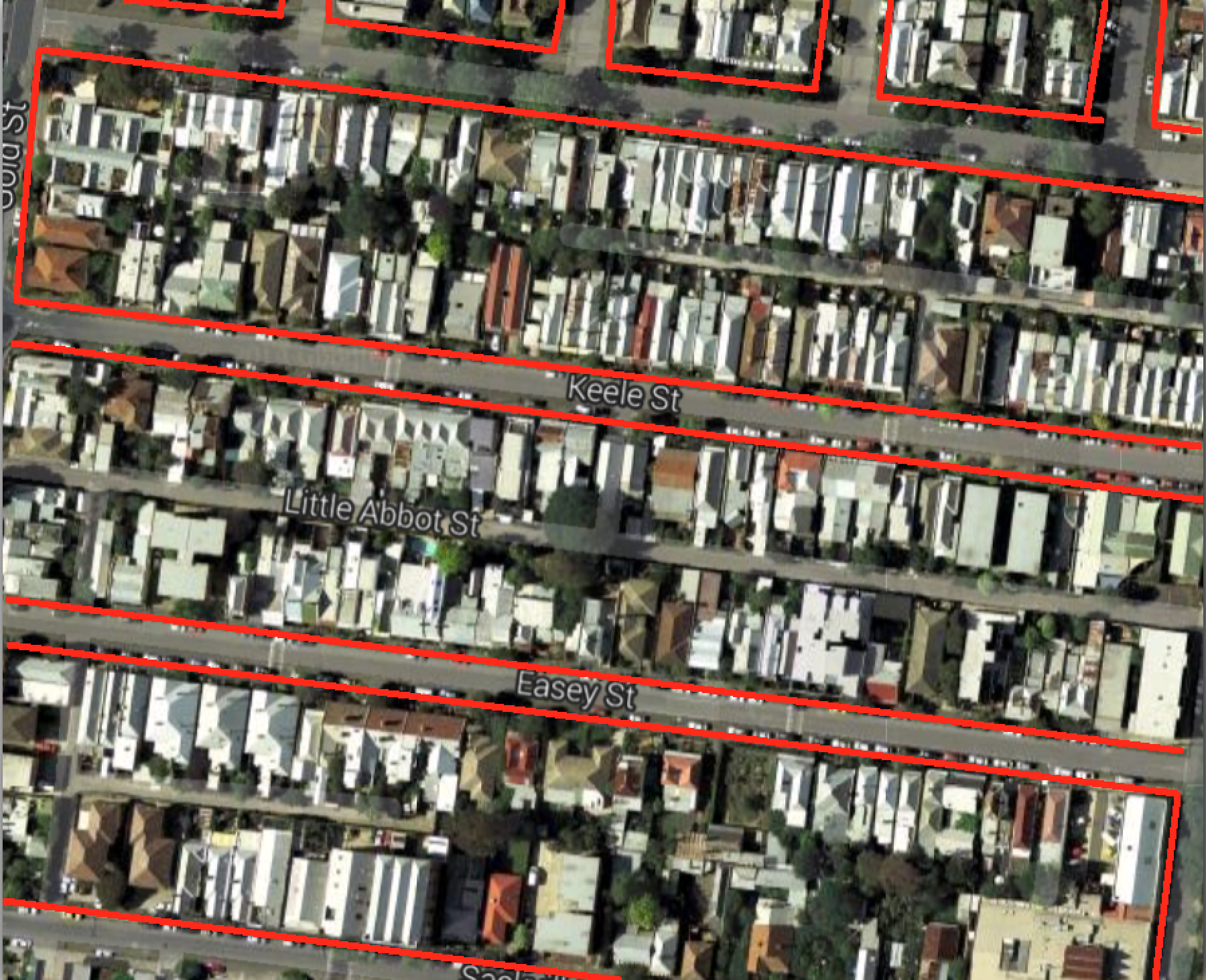
Sell off the street in front of your house for development, leaving only walking access.
Streets – outlined in red – take up about 30 per cent of this area in the backstreets of Collingwood.
Google maps draws streets as thin little lines, but that is misleading. They can be wide, sometimes more than half as wide as the blocks are deep. Is dedicating so much land to traffic really wise? Especially where you have dead-ends, those streets are minimally used. The last 20 metres of a cul-de-sac might see only 10 car trips a day. To me, that seems wasteful.
Selling off your street would be unacceptable in a scenario where house prices were low. But Australia’s house prices are high. It makes sense to use land for its most valuable purpose.
The land in front of my house and the neighbours (which is also, of course, in front of our neighbours opposite), might be worth $500,000. If the decision to sell it off meant a windfall of $125,000 for all four parties, all parties might be tempted.
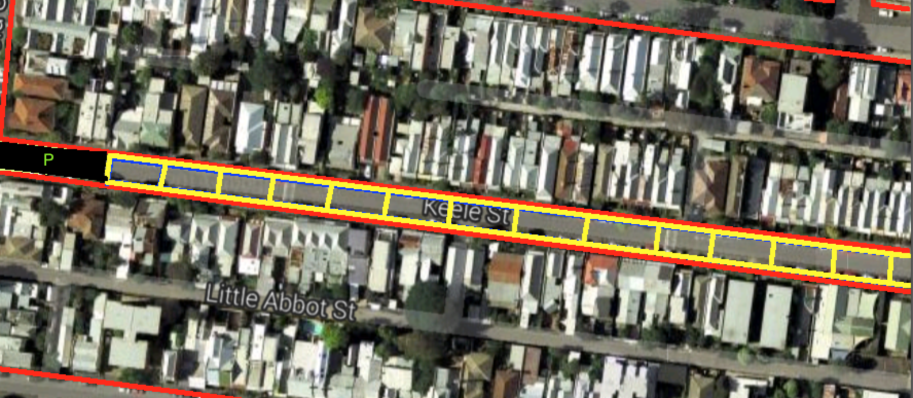
The way to make this work would be to build a parking structure within a reasonable distance. The land at the end of the street, nearest to the main road, would be a logical place for that.
Yellow squares would be new lots for development, black area at left is new parking area
This hypothetical might seem odd. It’s not standard to think of suburban streets as optional. But we should ask why they are compulsory.
Walkable laneways for access are part of some very desirable housing options, including big resorts and hotels, big apartment developments, and whole cities, including this car-free city in China, the “old towns” of many cities of Europe, and of course, this little place in Italy.
I was inspired to think about whether we really need all our suburban streets after reading about road pricing in a recent speech by the head of the Productivity Commission.
There are already tolls on some of our most popular roads. But the vast majority of roads (by length and by area under tarmac) are side streets. Attempting full cost recovery for these would be very expensive for the people who use them.
If my street cost $10 million to build and requires a return of 7 per cent, the locals must generate $700,000 a year in revenue. If there are 50 car trips a day ( a car every 20 minutes in the 16 waking hours), those trips will be charged at $38 each. Ouch.
You might not sell off the land in front of your house when the alternative is a lovely street you get to use free of charge. But if that street were tolled, the combined carrot and stick might change your mind fast.
If you lived on a main road, obviously it would not be in the public interest for the land in front of your house to be sold. But equally, the number of people using that road would be much higher, so the toll would be a lot lower and the “stick” part of the equation less compelling.
Obviously there would be massive coordination problems and equity challenges associated with such a plan. Selling off the road at both ends of the street would pretty much force the people in the middle to do the same. And if someone with major mobility problems lived on your street it might be unfair. This hypothetical question will remain hypothetical for a very long time.
But the fundamental issue here is not unlike the question of burying rail lines, providing surface parking, or putting roads in tunnels. What is the most valuable use of our scarce city land, and how much are we relying on legacy structures to determine those uses?